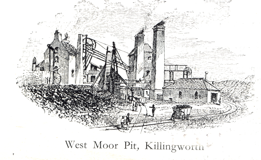
Killingworth Colliery, West Moor Pit
Killingworth Colliery, West Moor Pit
HER Number
1082
District
N Tyneside
Site Name
Killingworth Colliery, West Moor Pit
Place
Killingworth
Map Sheet
NZ27SE
Class
Industrial
Site Type: Broad
Coal Mining Site
Site Type: Specific
Colliery
General Period
POST MEDIEVAL
Specific Period
Hanoverian 1714 to 1837
Form of Evidence
Documentary Evidence
Description
Killingworth Colliery, West Moor Pit. 1st edn OS mapping is unclear but seems to show two shafts, a cistern, a sluice and a gin within the mine. The colliery was served by a wagonway (SMR 1083). This may have been the pit opened by the Grand Allies in 1761, it was certainly opened before 1806 and was closed by 1900. Lord Ravensworth & Partners owned it in the 1800s. Colliery disasters - explosions killed 5 on 18 january 1844, 10 on 3 April 1845 and 9 on 31 October 1851.
Easting
427270
Northing
570500
Grid Reference
NZ427270570500
Sources
<< HER 1082 >> 1st edition Ordnance Survey map, 1864, 6 inch scale, Northumberland, 80
C.R. Warn, 1976, Wagonways & Early Railways of Northumberland, p.10
I. M. Ayris, Northumberland Mining Records Survey; Durham Mining Museum www.dmm.org.uk; F. Atkinson, 1980, North East England - People at Work 1860-1950; W.G. Elliott and Edwin Smith, Bygone Days of Longbenton, Benton, Forest Hall, West Moor and Killingworth, p 74; Roy Thompson, 'How long did the ponies live? The story of the colliery of Killingworth and West Moor'; Roy Thompson, 2004, Thunder Underground - Northumberland Mine Disasters 1815-65, p 22, 62, 71-79; S Smiles, 1868, Life of the Stephensons; Alan Williams Archaeology, 2012, Developments at Comet Row, Killingworth - Archaeological Assessment; Archaeological Services Durham University, 2015, Southgate, Killingworth - Archaeological Assessment