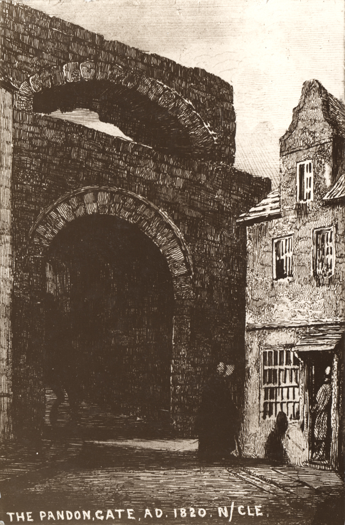
Newcastle town wall, Pandon Gate
Newcastle town wall, Pandon Gate
HER Number
1560
District
Newcastle
Site Name
Newcastle town wall, Pandon Gate
Place
Newcastle
Map Sheet
NZ26SE
Class
Defence
Site Type: Broad
Town Defences
Site Type: Specific
Town Wall
General Period
MEDIEVAL
Specific Period
Medieval 1066 to 1540
Form of Evidence
Demolished Building
Description
Pandon Gate was situate in the bed of the deep gorge through which Pandon- dean runs to the Tyne. It was one of the lesser gates, perhaps like Sand Gate, had a single archway for traffic, and was defended with folding iron gates but had no portcullis. In the early 17th century until 1648, the gate was used as the meeting hall of the Company of Barber Surgeons. In 1639 it was put it into a defensive state. Most of the gate was demolished in 1795, but the west abutment was still standing when City Road was under construction – this may still be under the road.
Easting
425390
Northing
564140
Grid Reference
NZ425390564140
Sources
<< HER 1560 >> Illustration M.A. Richardson, 1842, Local Historian's Table Book, Historical Division, II, 374
J. Brand, 1789, History of Newcastle, I, 17
G.B. Richardson, 19th century, The Walls of Newcastle, 205-208 -Newcastle University Library Unpublished MS
S. Holmes, 1896, The Town Walls of Newcastle upon Tyne, Archaeologia Aeliana, 2, XVIII, 19
J. Brand, 1789, History of Newcastle, I, 17
G.B. Richardson, 19th century, The Walls of Newcastle, 205-208 -Newcastle University Library Unpublished MS
S. Holmes, 1896, The Town Walls of Newcastle upon Tyne, Archaeologia Aeliana, 2, XVIII, 19