North Pier
North Pier
HER Number
2065
District
N Tyneside
Site Name
North Pier
Place
Tynemouth
Map Sheet
NZ36NE
Class
Maritime
Site Type: Broad
Landing Point
Site Type: Specific
Pier
General Period
POST MEDIEVAL
Specific Period
Victorian 1837 to 1901
Form of Evidence
Structure
Description
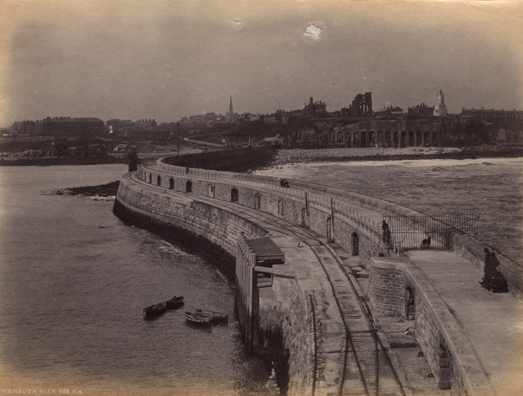
The North Pier, Tynemouth, is a rock-faced stone pier and north shelter wall, with iron crane. A painted rendered ashlar lighthouse with a glass lantern stands at the end of the pier. The construction is of two parallel walls, connected by cross walls, filled with quarry debris and, further out to sea, concrete. It stands on a rubble foundation, up to 27feet below low water level. The pier is 2900 feet (c.900 metres) long with a gap of 1180 feet to the South pier. Construction between 1854-1895 overseen by various engineers, including W.A.Brookes, J.F.Ure and P.J.Messant, who encountered numerous problems. It was breached in 1897 and rebuilt by 1909. The pier is one of a pair, with South Shields South Pier. LISTED GRADE 2
Easting
437425
Northing
569300
Grid Reference
NZ437425569300
Sources
<< HER 2065 >> 1st edition Ordnance Survey map, 1865, 6 inch scale, Northumberland 89
I.M. Ayris, & S.M. Linsley,1994, A Guide to the Industrial Archaeology of Tyne and Wear, p.27
The Engineer, 1910, The Reconstruction of the Tyne North Pier Jan 28th 1910, Proceedings Prehistoric Society, 89-92
Dept. of National Heritage, of Buildings of Special … Interest, 10/111 & 8/111
J. Alexander, 1999, Images of England: Tynemouth & Cullercoats, p 60-61, 72; J. Guthrie, 1880, The River Tyne; R.W. Johnson, 1895, The Making of the Tyne; Dick Keys and Ken Smith, 2005, Tall Ships on the Tyne, p 10