Newton Garths Farm
Newton Garths Farm
HER Number
5482
District
S Tyneside
Site Name
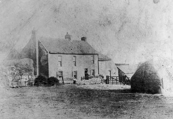
Newton Garths Farm
Place
Newton Garths
Map Sheet
NZ36SE
Class
Agriculture and Subsistence
Site Type: Broad
Farm
Site Type: Specific
Farmstead
General Period
POST MEDIEVAL
Specific Period
Hanoverian 1714 to 1837
Form of Evidence
Extant Building
Description
There was a 'Garths Farm' in this area in 1714 but this was not on the same site as the present Newton Garths Farm. The present farm buildings probably date to the late eighteenth or early nineteenth century, but an earlier date cannot be ruled out. The farm is shown but unnamed on the 1840 tithe map. Confusingly, the farm to the north-west of this was called 'Newton Garths' at that time and was in the ownership of Cuthbert Ellison Esquire. By 1855 this farm was ruinous and the name was adopted by its neighbour. The buildings which now form 'Newton Garths Farm' were certainly in existence by 1855, as they are shown on 1st edition Ordnance Survey map in the same basic form which survives today. Three ranges of buildings surround a courtyard, open to the south, with a gin house on the eastern range. The Ordnance Survey second edition shows that the east and west ranges had changed little, but the north and south ranges had been extensively rebuilt and building three was added. Side walls had been added to the horse gin by 1912. The farm buildings were recorded in 2003 in advance of conversion. The floor of building 2 may be original as it shares some characteristics with the late 18th century floors of the stable block at Gibside. The gin house survives but its once open sides are now blocked up with modern bricks. Building 1 probably housed the mechanical apparatus which was driven by the horse gin. Building 2 was probably stables. The roofline of building 2 was raised in the mid 19th century. Building 3 was built in the late 19th century. Building one is of yellow sandstone. It retains narrow ventilation slots and a stable door. Building 2 is built of whitewashed hand-made brick with sandstone gable springers. There is a blocked doorway in the east elevation, and a window in the north. The two stable doors are still in use. Building 3 is made of wire-cut brick construction.
Easting
435470
Northing
562640
Grid Reference
NZ435470562640
Sources
<< HER 5482 >> W. Greenwell, ed. 1852, Boldon Buke, Surtees Society,25, 45-6
W. Greenwell, ed. 1856, Bishop Hatfield's Survey, Surtees Society, 32, 98
18th century, Deeds relating to Newton Garths, Northumberland Records Office- ZCE 9/11
W. Hutchinson, 1787, History...of Durham, II, 624-25
R. Surtees, 1820, History...of Durham, II, 64
The College, Ordnance Survey maps, 1st ed. 25, VII.4 and III.16-Durham University Special Collections 5
D.A. Kirby, ed. 1972, Parliamentary Surveys of the Bishopric of Durham, Surtees Society, II 185, p.
The College, Tithe Awards, 1840, Whitburn - Durham University Special Collections 5
C. Maire, 1711
Casson, 1801
Pre Construct Archaeology, 2003, An Archaeological Building Survey at Newton Garth Farm, 1 Benton Road,