Main Road, Robert Young Memorial Chapel
Main Road, Robert Young Memorial Chapel
HER Number
6399
District
Gateshead
Site Name
Main Road, Robert Young Memorial Chapel
Place
Crawcrook
Map Sheet
NZ16SW
Class
Religious Ritual and Funerary
Site Type: Broad
Place of Worship
Site Type: Specific
Methodist Chapel
General Period
POST MEDIEVAL
Specific Period
Victorian 1837 to 1901
Form of Evidence
Extant Building
Description
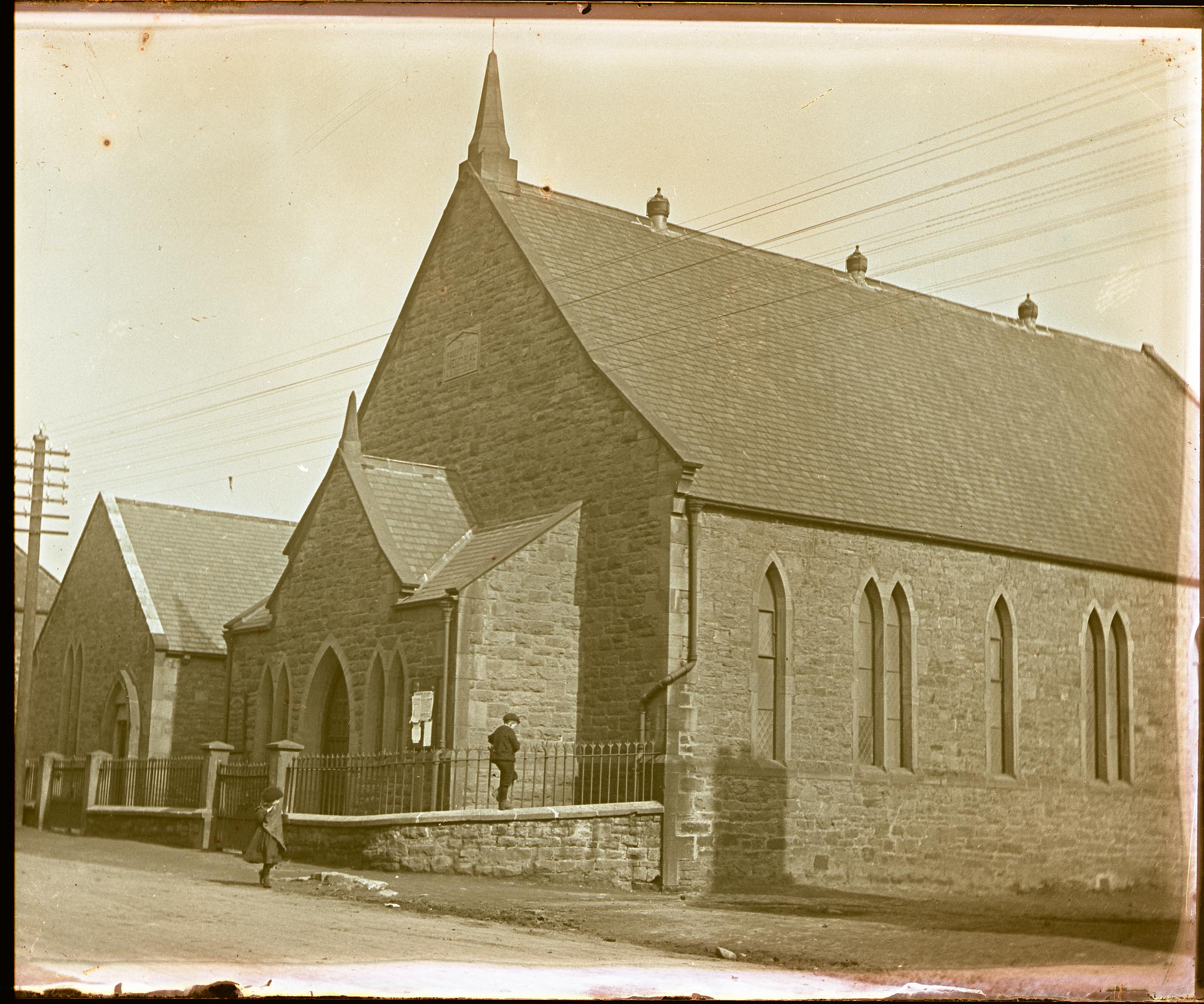
Shown on 2nd edition Ordnance Survey map as a methodist chapel. This chapel was raised in memory of the local Methodist preacher and missionary Robert Young. He was well thought of and the local Methodist community were proud to be associated with him. It is well built with un-lavish but individual detailing.
Chapel building of 1 storey with single storey hall adjoining to the east side. They are both constructed of sandstone rubble with ashlar detailing. The stone was hewn by the trustees and some helpers from a local quarry between Emmaville and the Wylam Road, using borrowed carts. The roof of the church is of Welsh slate with slightly swept water tables to each gable terminating in decorative kneelers. There is a chamfered plinth course beneath the windows to the sides incorporating the sills. To the principal (north) elevation there is a stone pinnacle atop the gable, and a large porch below which is gabled to the centre but flanked by ŌĆślean-toŌĆÖ pitches. This also has water tables with kneelers, and it crowned by a smaller pinnacle of the same design. The timber plank door sits between 2 pairs of lancets ŌĆō the lancet pairs being repeated to the side with single lancets interspersed. The hall is similar with a lower ridge line, with the door being set in a moulded stone surround with tudor arch in the east side of the porch. A lancet pair is the central feature of the street elevation. There are some original cast iron rainwater goods with decorative hopper heads. MATERIALS Sandstone, slate, cast iron ARCHITECT Charles Wesley Hutchinson DATES 1875 LOCAL LIST
Chapel building of 1 storey with single storey hall adjoining to the east side. They are both constructed of sandstone rubble with ashlar detailing. The stone was hewn by the trustees and some helpers from a local quarry between Emmaville and the Wylam Road, using borrowed carts. The roof of the church is of Welsh slate with slightly swept water tables to each gable terminating in decorative kneelers. There is a chamfered plinth course beneath the windows to the sides incorporating the sills. To the principal (north) elevation there is a stone pinnacle atop the gable, and a large porch below which is gabled to the centre but flanked by ŌĆślean-toŌĆÖ pitches. This also has water tables with kneelers, and it crowned by a smaller pinnacle of the same design. The timber plank door sits between 2 pairs of lancets ŌĆō the lancet pairs being repeated to the side with single lancets interspersed. The hall is similar with a lower ridge line, with the door being set in a moulded stone surround with tudor arch in the east side of the porch. A lancet pair is the central feature of the street elevation. There are some original cast iron rainwater goods with decorative hopper heads. MATERIALS Sandstone, slate, cast iron ARCHITECT Charles Wesley Hutchinson DATES 1875 LOCAL LIST
Easting
414010
Northing
563780
Grid Reference
NZ414010563780
Sources
2nd edition Ordnance Survey map; Gateshead Council Local List X20/LL/175; W Bourn, 1893, History of the Parish of Ryton